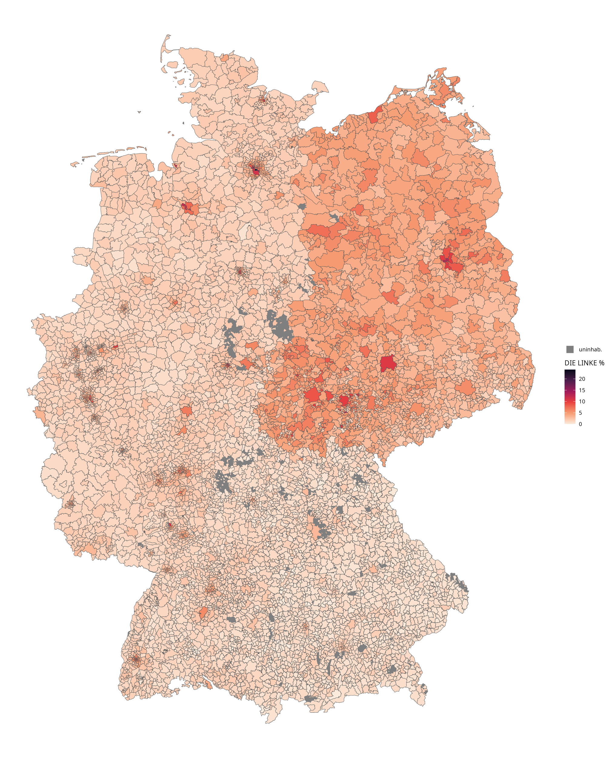
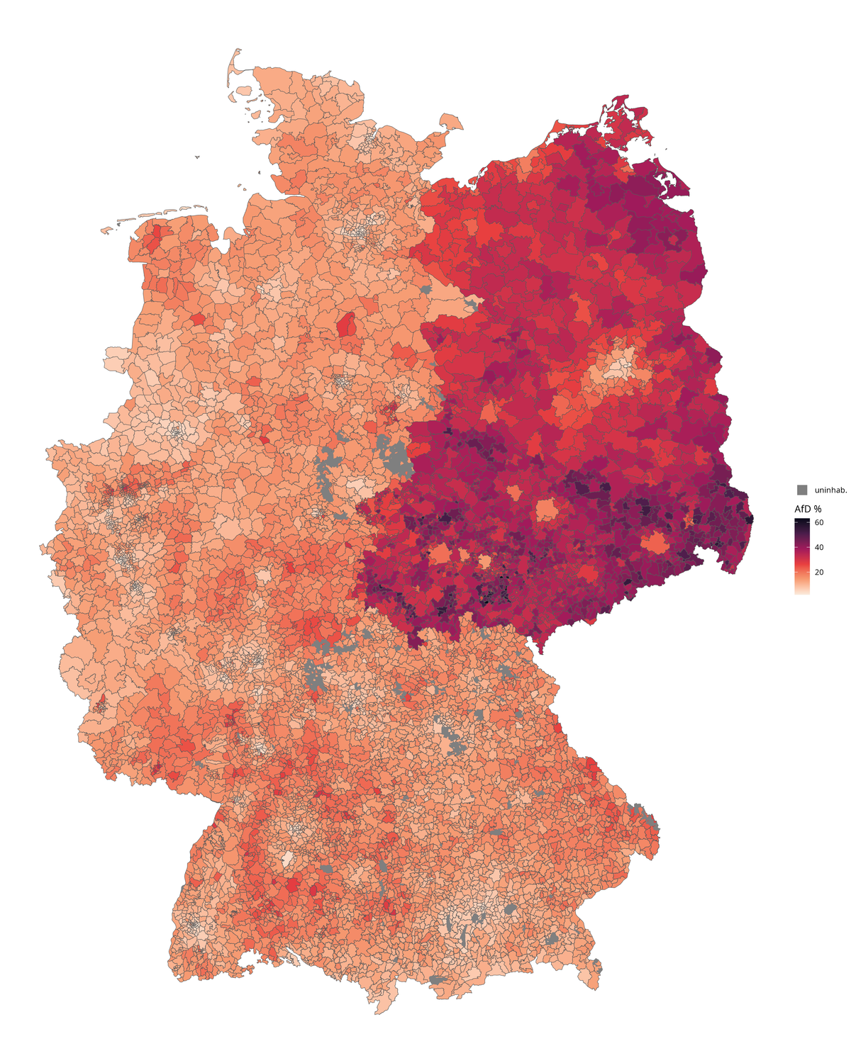
EU election results 2024
Territorial division
Germany is administratively divided into rural districts (Landkreise) and urban districts (Stadtkreise). The way this division (and further subdivisions) is implemented depends heavily on the state.
Urban districts
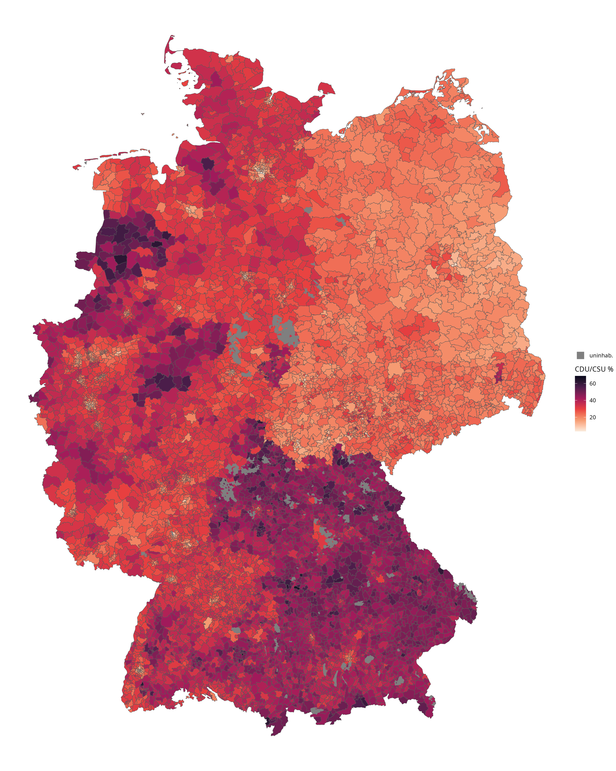
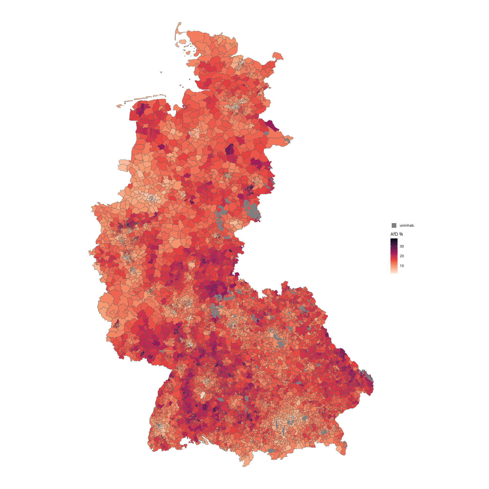
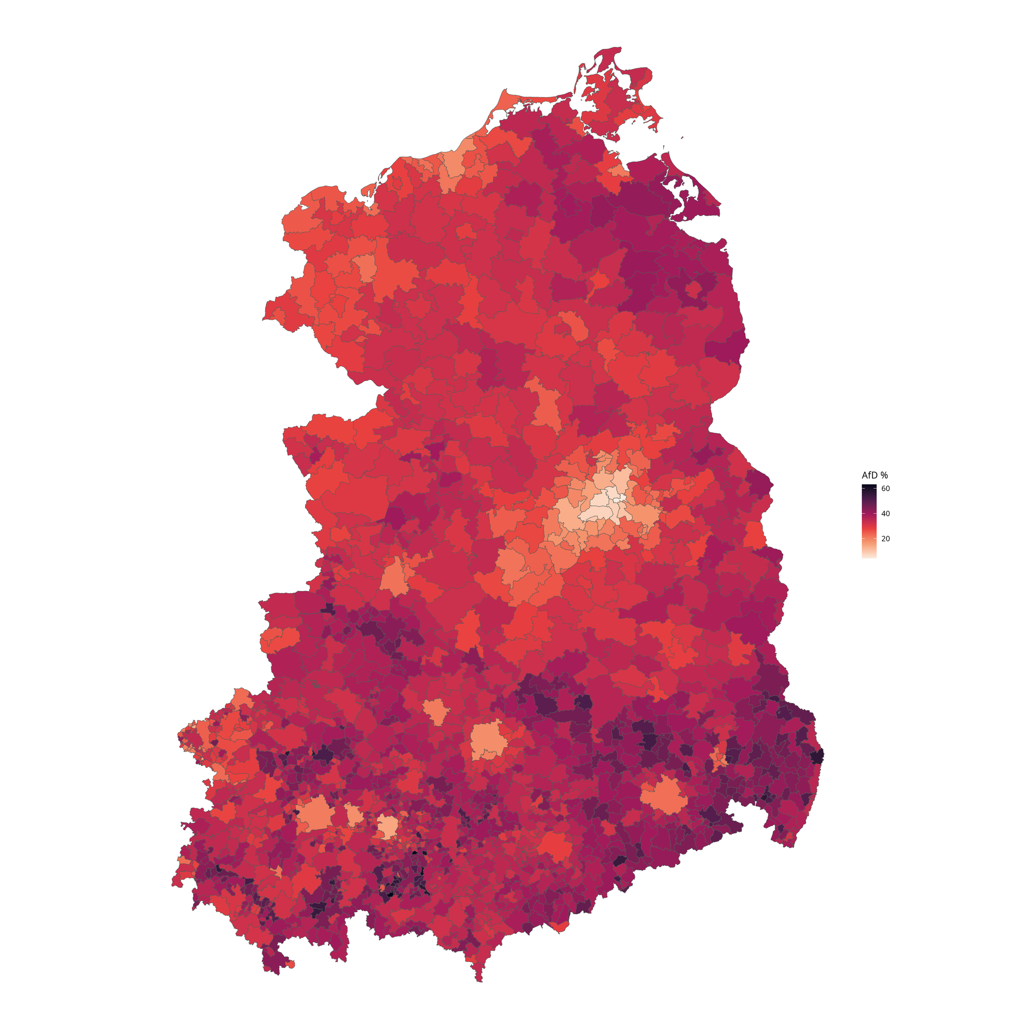
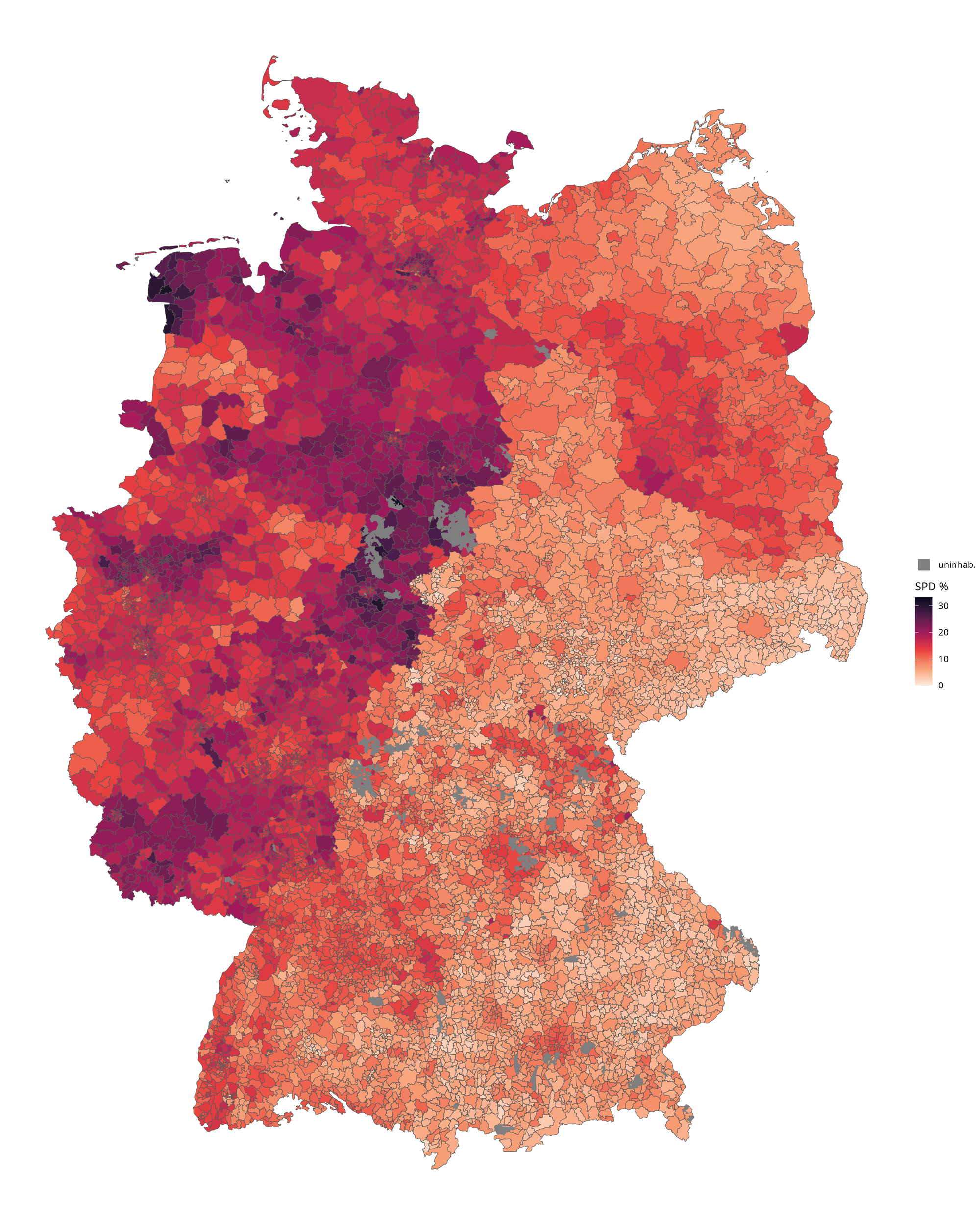
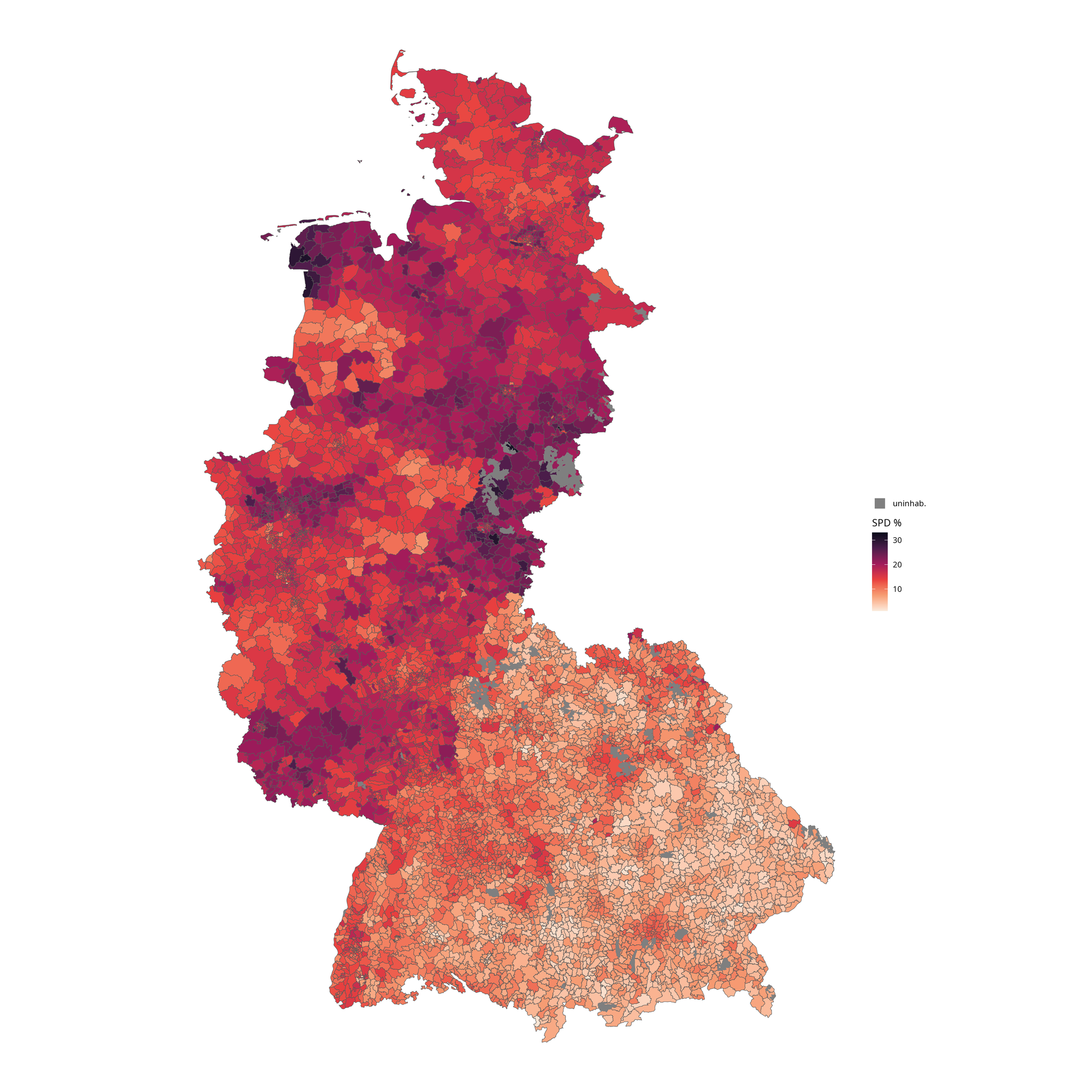
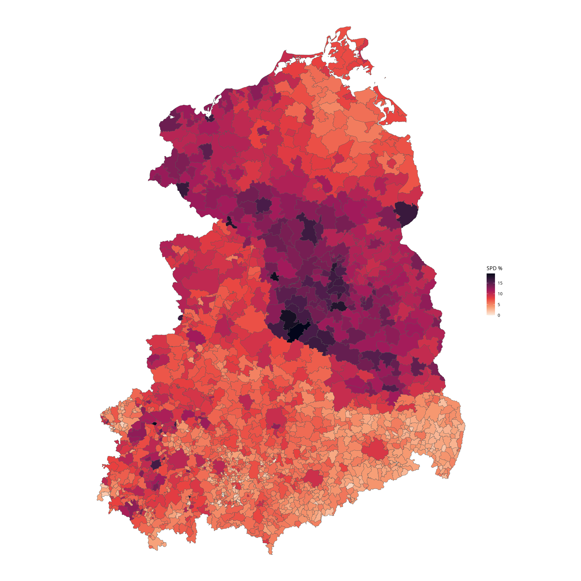
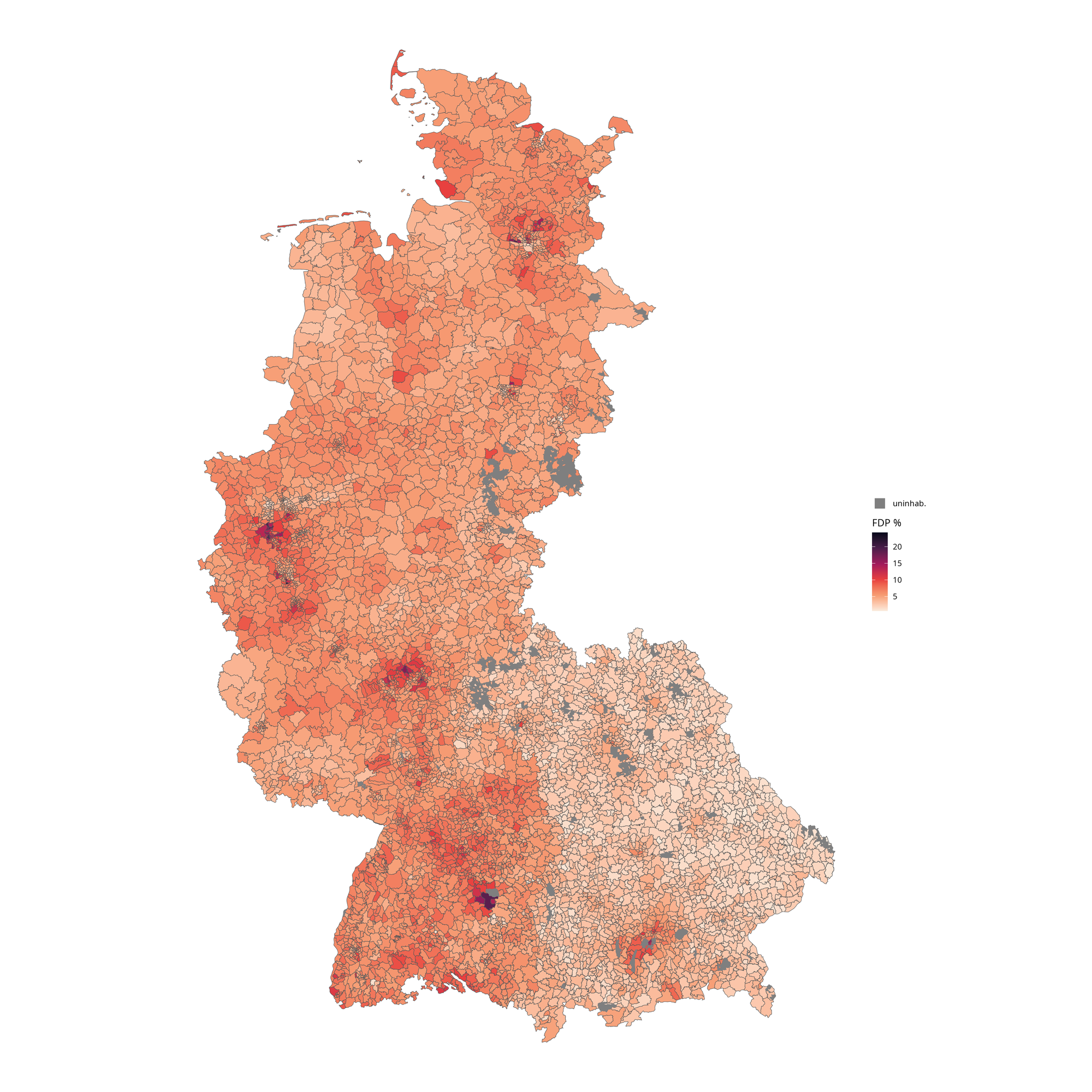
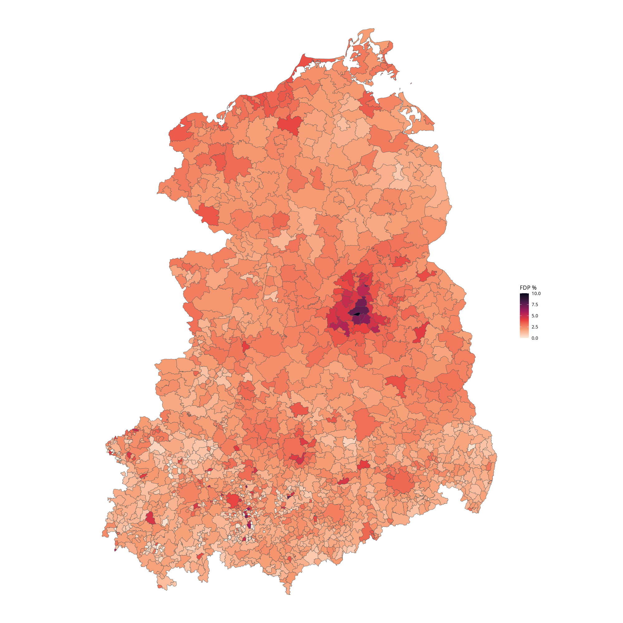
Urban districts have no standardized or official subdivision. The maps use, wherever possible, city districts or city boroughs to increase the resolution of the data. Almost all West German urban districts have been subdivided for the maps while only a few East German urban districts have been subdivided.
Rural districts
Rural districts are divided further into municipalities. In some states with extremely small municipalities (such as Rhineland-Palatinate or Lower Saxony) an intermediate administration level exists. In these states these "collective municipalities" haven been used.
Data Source and Mapping
All voting data originates from the individual districts. The map data is based on OpenStreetMap.
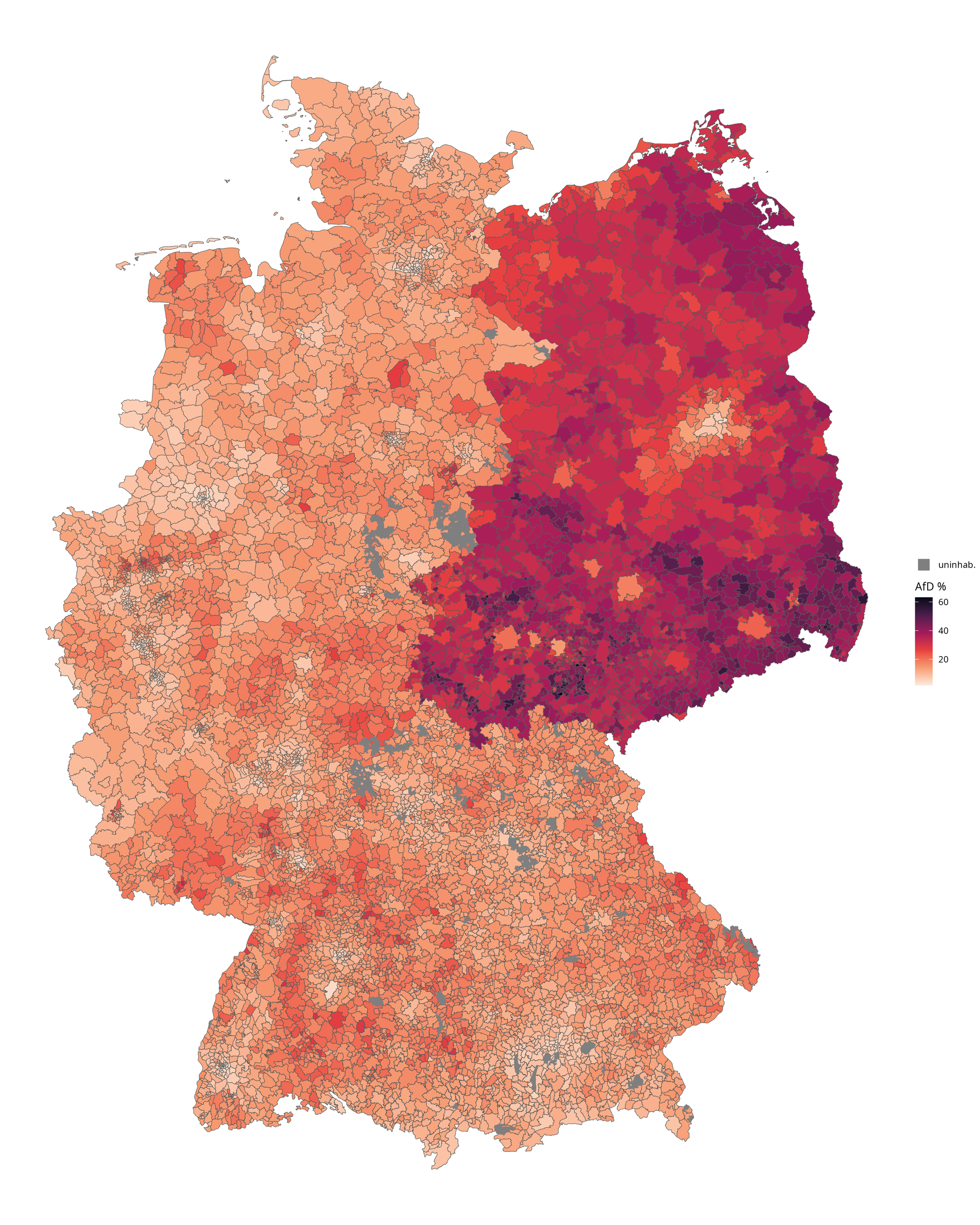
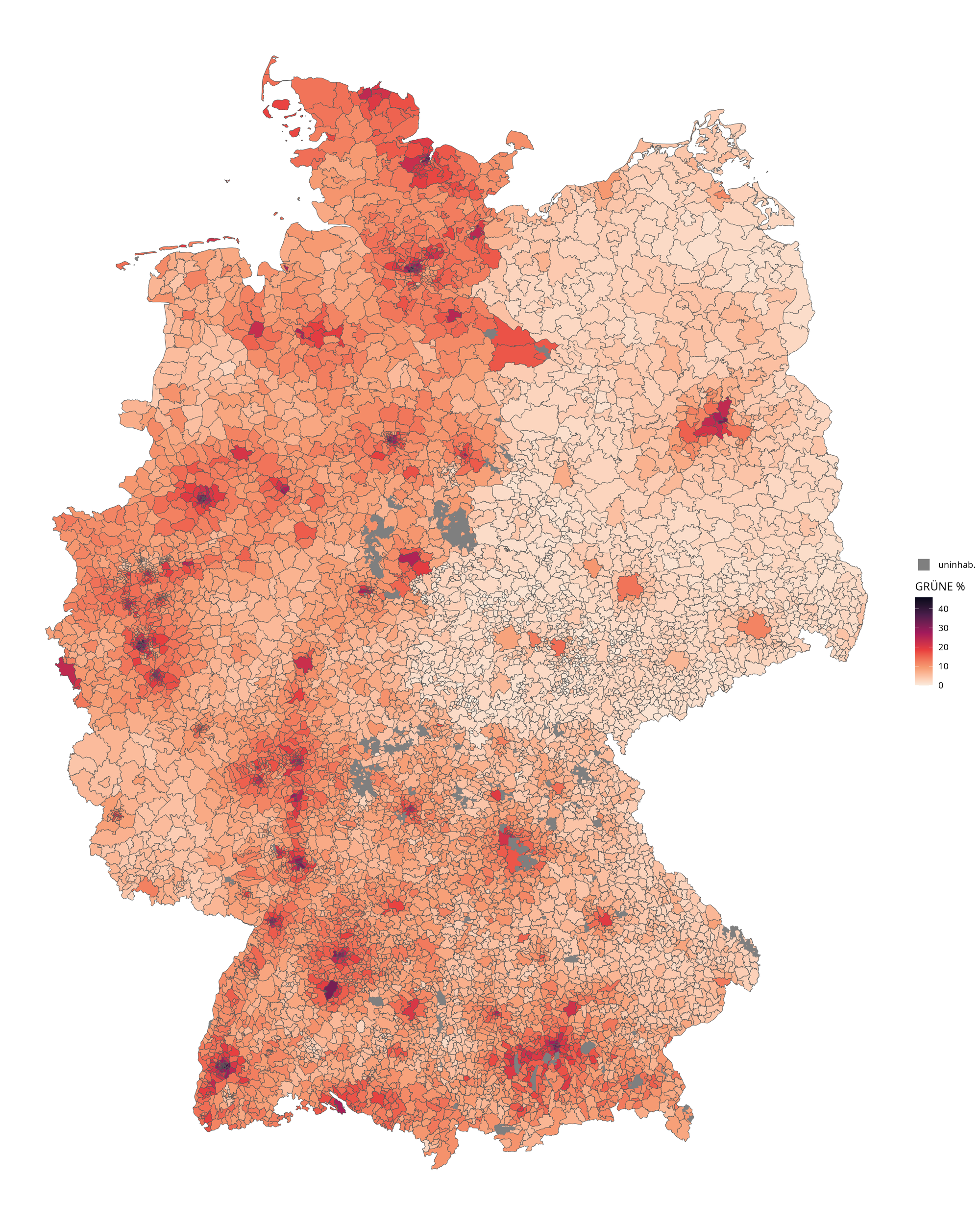
The grey areas of the map are the few areas of Germany which do not belong to a district and are uninhabited. These unincorporated (gemeindefrei) areas typically are forests or military areas.
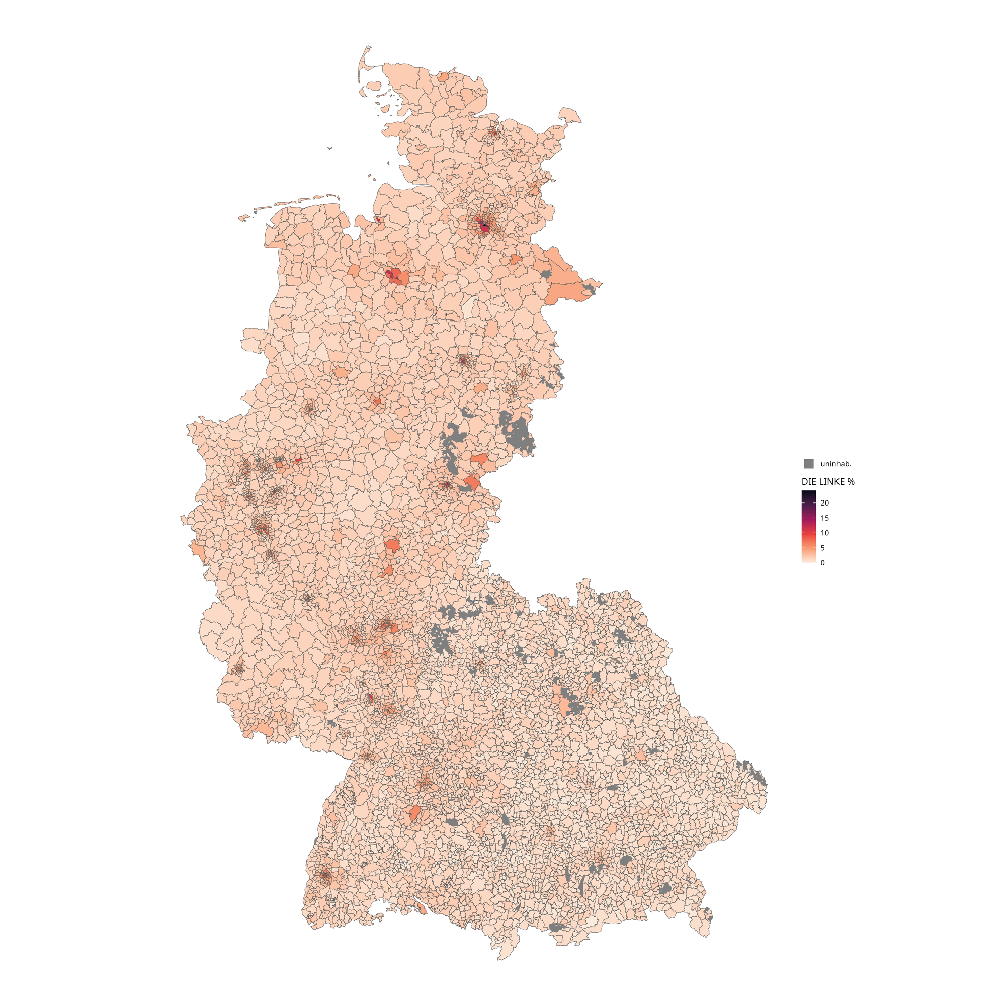
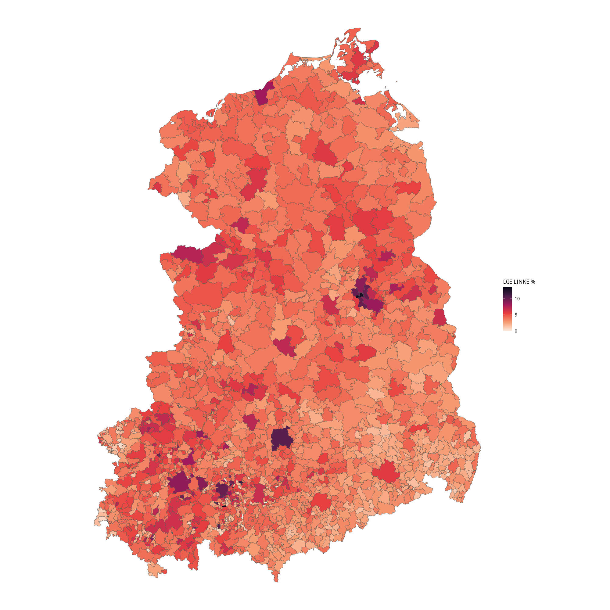
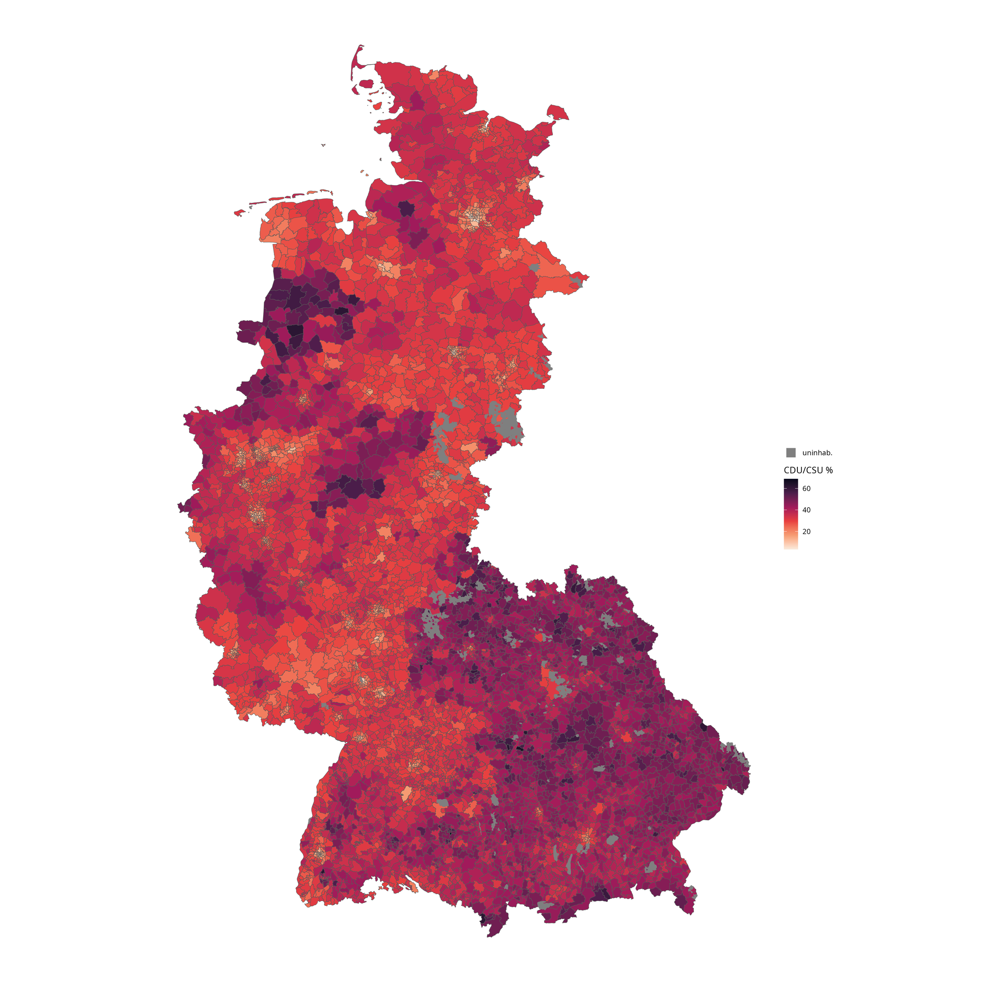
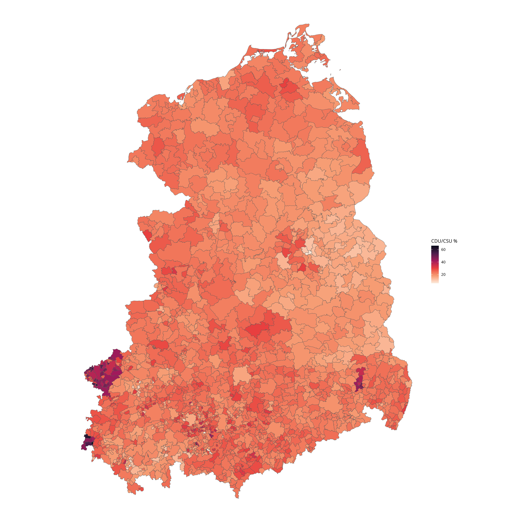
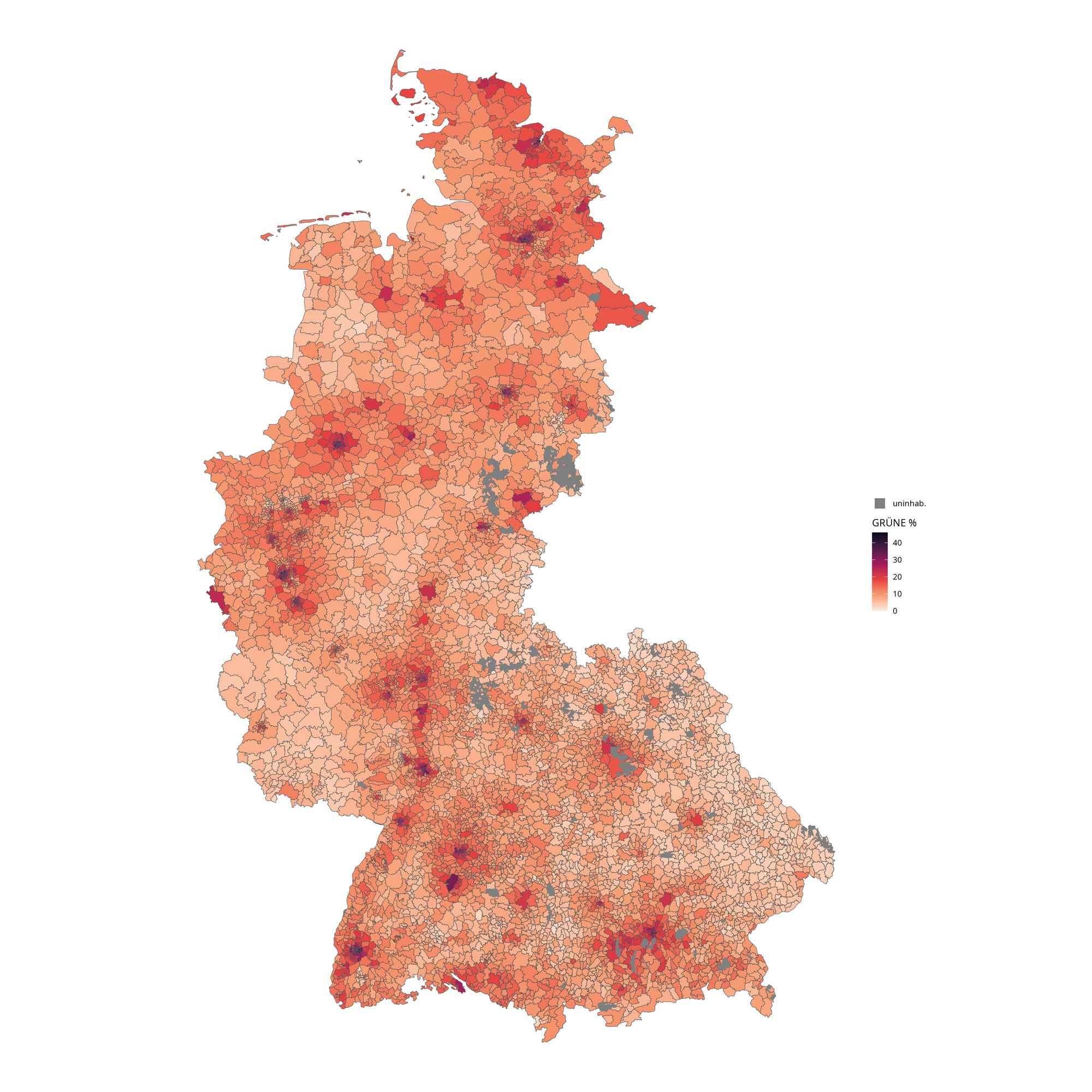
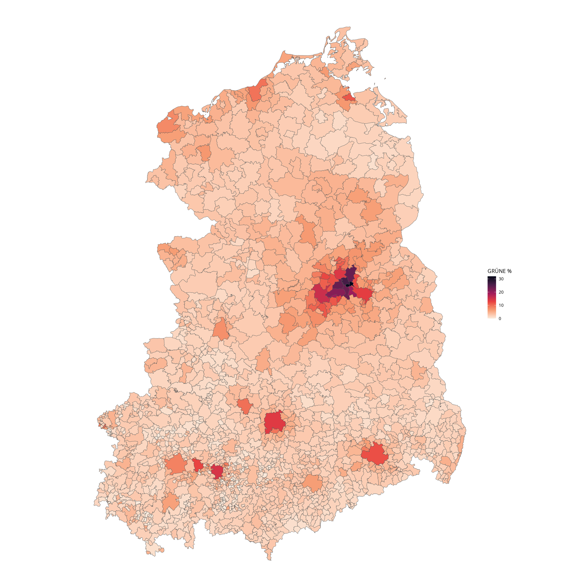
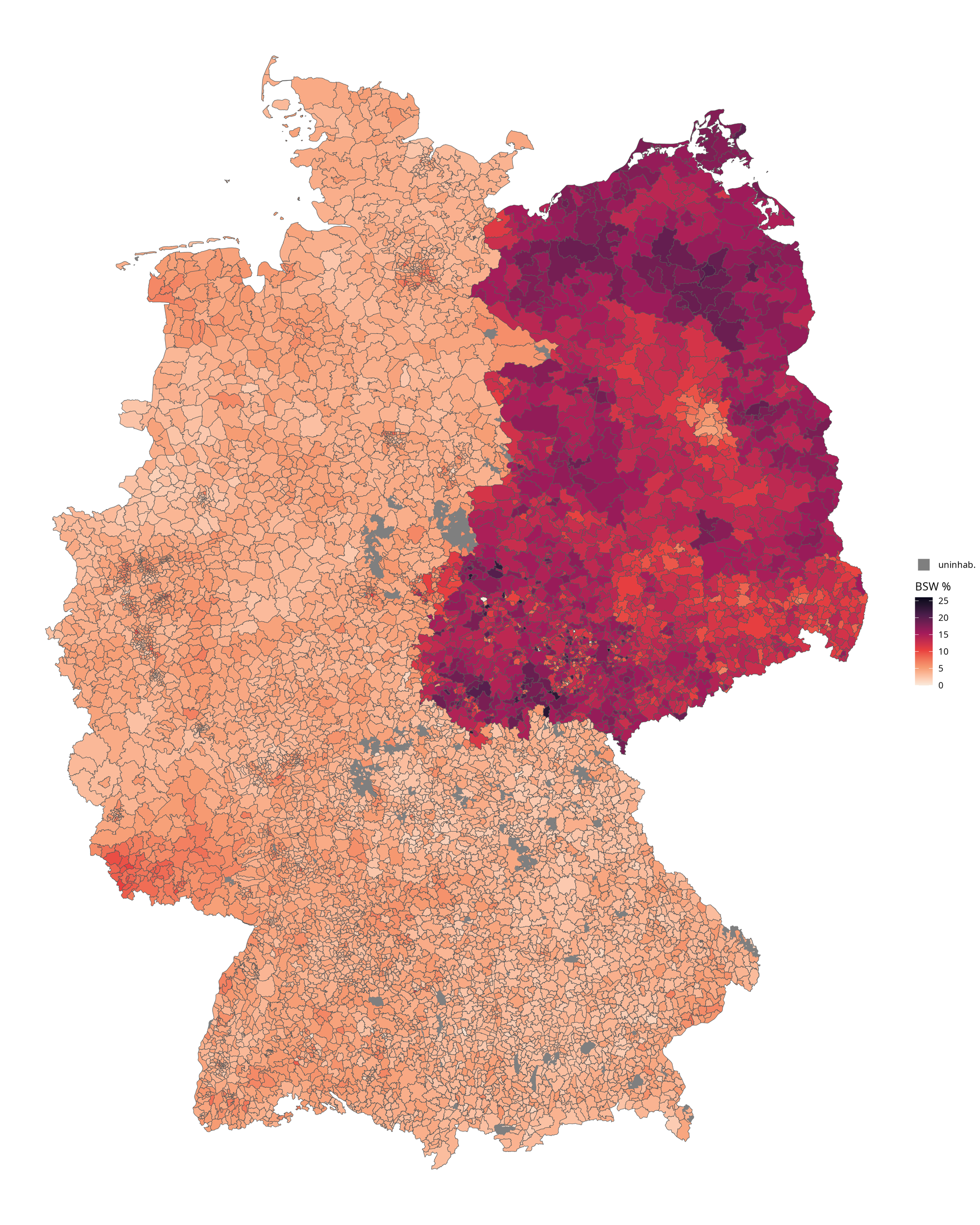
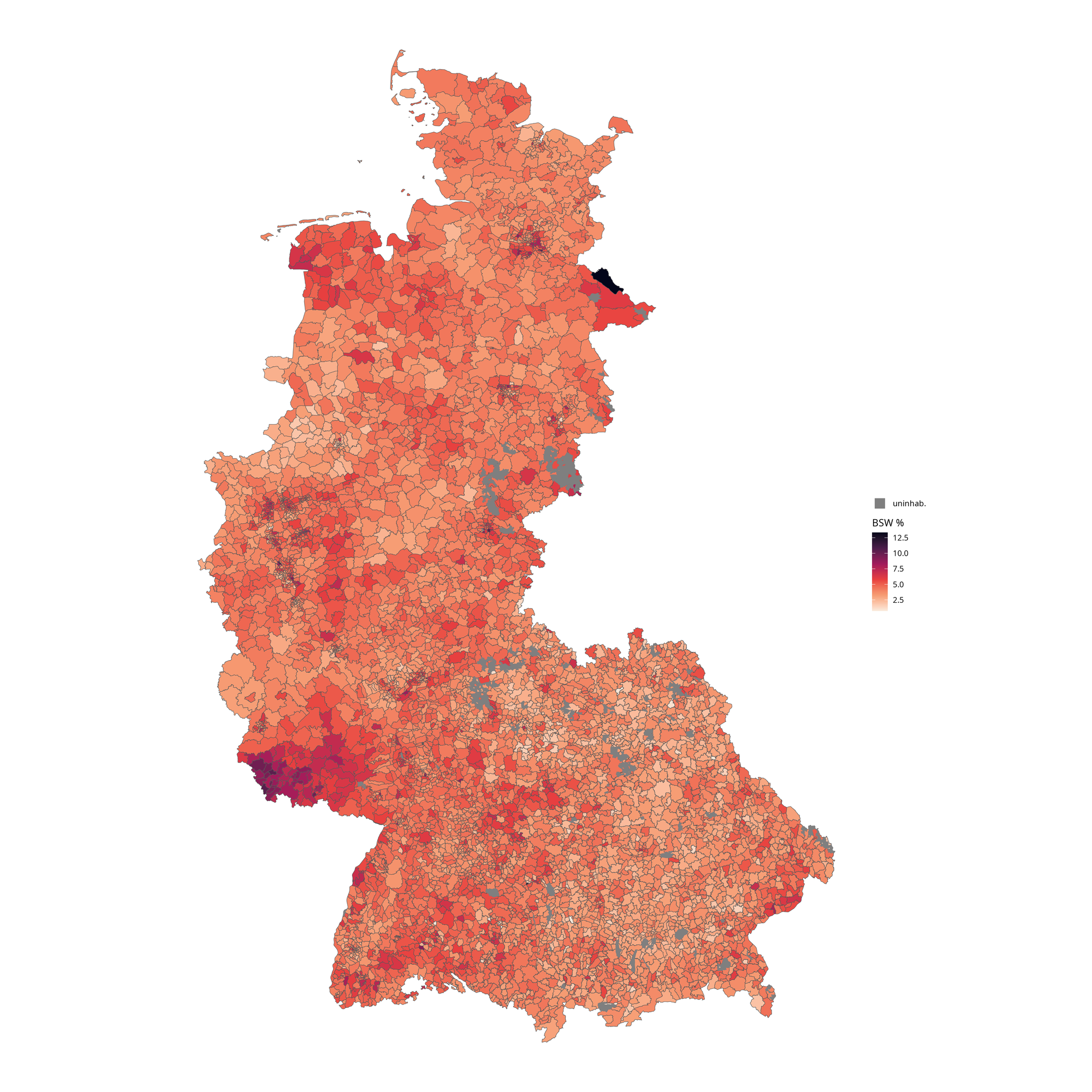
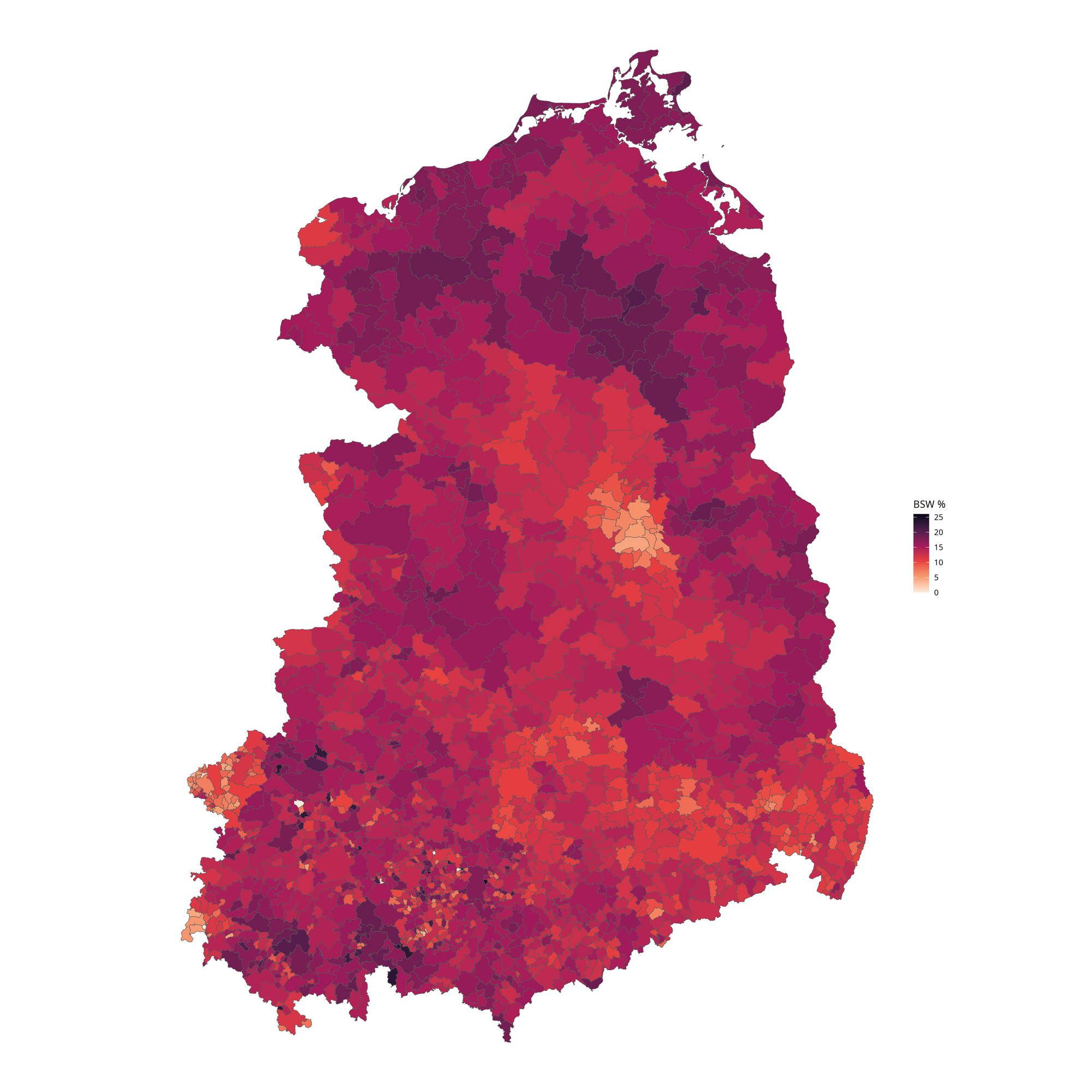
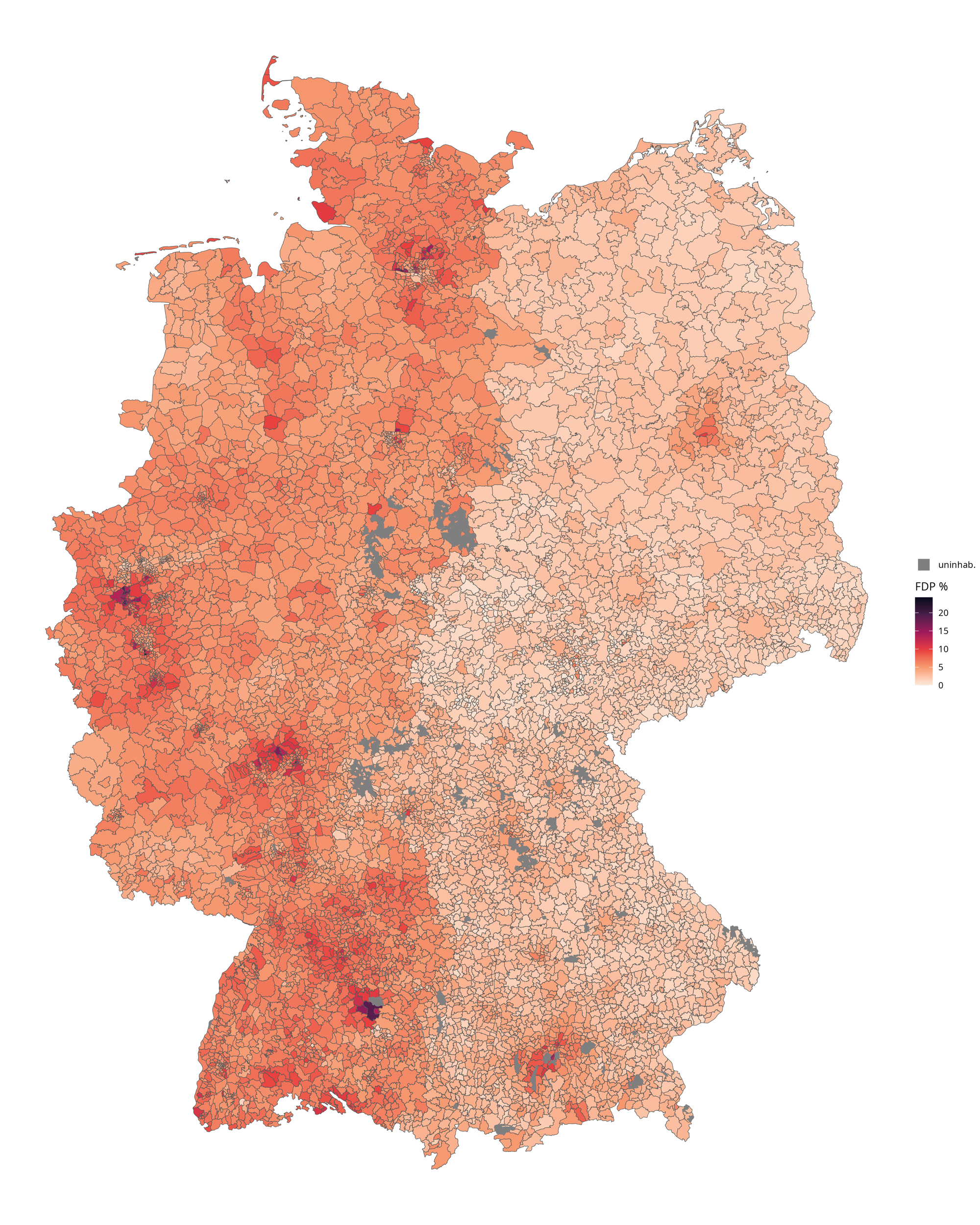
Due to the different voting patterns in West and East Germany, separated maps are provided to allow for more granularity. Please note, that the same type of coloring is used but with a different scale in each plot.
CDU/CSU
AfD
SPD
Grüne
BSW
FDP
Die Linke
